This season · fall 2026
Fall colors within 3 hours 30 minutes of Mooresville, NC
- Mountain towns
- 15
- Highest town
- 5,506 ft
Blowing Rock (1 hr 37 min), Sugar Mountain (2 hr 4 min) and Maggie Valley (2 hr 35 min) lead the towns within 3 hours 30 minutes of Mooresville, NC for fall color. At 3,630 ft, Blowing Rock usually peaks mid-October.
- Highest town listed
- Beech Mountain, 5,506 ft: peaks late September to early October
- Closest
- Sparta, 1 hr 23 min
- Near the Blue Ridge Parkway
- 14 of the 15 towns, within about 10 miles of it
- Usually at peak about now
- None of these towns, in a typical year
Color starts on the highest ground in late September or early October and works its way down the mountains into early November. Each town below shows when its color usually peaks; check the live reports before you go.
2026 is running about a week late. After a warm September, Dr. Howard Neufeld expects the mid-elevation peak about a week later than usual: each degree above normal delays it by about two days. Dr. Howard Neufeld to WLOS, 1 October 2026 (interview) (opens in a new tab)
01 · Where to go
The mountains, best for color first
Towns at 2,000 ft or higher, or within about 10 miles of the Blue Ridge Parkway. Drive times by road from Mooresville; elevations at each town’s centre.
Blowing Rock, NC
Drive from Mooresville: 1 hr 37 min
3,630 ft · usually peaks mid-OctoberUsually past peak
Overlooks: Grandview Overlook (opens in a new tab), Grandfather Mountain Overlook (opens in a new tab), Stoney Fork Overlook (opens in a new tab)
Waterfalls: New Year's Creek Cascades (opens in a new tab), Glen Burney Falls (opens in a new tab), Upper Glen Marie Falls (opens in a new tab)
State parks: Grandfather Mountain State Park (opens in a new tab), Bear Paw State Natural Area (opens in a new tab), Beech Creek Bog State Natural Area (opens in a new tab)
Within about 10 miles of the Blue Ridge Parkway
Sugar Mountain, NC
Drive from Mooresville: 2 hr 4 min
4,560 ft · usually peaks early to mid-OctoberUsually past peak
Overlooks: Grandfather Mountain Overlook (opens in a new tab), Elk River Falls (opens in a new tab), Upper Falls Overlook (opens in a new tab)
Waterfalls: Linville Falls (opens in a new tab), Elk River Falls (opens in a new tab), Splash Dam Falls (opens in a new tab)
State parks: Grandfather Mountain State Park (opens in a new tab), Roan Mountain State Park (opens in a new tab), Hampton Creek Cove State Natural Area (opens in a new tab)
Within about 10 miles of the Blue Ridge Parkway
Maggie Valley, NC
Drive from Mooresville: 2 hr 35 min
3,240 ft · usually peaks mid-OctoberUsually past peak
Overlooks: Plott Balsam Overlook (MP 457.9) (opens in a new tab), Woodfin Valley Overlook (MP 446.0) (opens in a new tab), Hornbuckle Valley (MP 453.4) (opens in a new tab)
Waterfalls: Soco Falls (opens in a new tab), Upper Mouse Creek Falls (opens in a new tab), West Prong Mouse Creek Falls (opens in a new tab)
Within about 10 miles of the Blue Ridge Parkway
Banner Elk, NC
Drive from Mooresville: 2 hr 7 min
3,860 ft · usually peaks mid-OctoberUsually past peak
Overlooks: Elk River Falls (opens in a new tab), Grandfather Mountain Overlook (opens in a new tab), Upper Falls Overlook (opens in a new tab)
Waterfalls: Linville Falls (opens in a new tab), Elk River Falls (opens in a new tab), Splash Dam Falls (opens in a new tab)
State parks: Grandfather Mountain State Park (opens in a new tab), Roan Mountain State Park (opens in a new tab), Hampton Creek Cove State Natural Area (opens in a new tab)
Within about 10 miles of the Blue Ridge Parkway
Glenville, NC
Drive from Mooresville: 3 hr 12 min
4,040 ft · usually peaks early to mid-OctoberUsually past peak
Overlooks: Whitewater Falls Overlook (opens in a new tab), Salt Rock Overlook (opens in a new tab), Purdy Point (opens in a new tab)
Waterfalls: Robinson Creek Falls (opens in a new tab), Verde Falls (opens in a new tab), Warden Falls (opens in a new tab)
State parks: Gorges State Park (opens in a new tab)
Boone, NC
Drive from Mooresville: 1 hr 40 min
3,330 ft · usually peaks mid-OctoberUsually past peak
Overlooks: Grandview Overlook (opens in a new tab), Stoney Fork Overlook (opens in a new tab), Grandfather Mountain Overlook (opens in a new tab)
Waterfalls: Hebron Colony Falls (opens in a new tab), New Year's Creek Cascades (opens in a new tab), Glen Burney Falls (opens in a new tab)
State parks: Grandfather Mountain State Park (opens in a new tab), Elk Knob State Park (opens in a new tab), Bear Paw State Natural Area (opens in a new tab)
Within about 10 miles of the Blue Ridge Parkway
Crossnore, NC
Drive from Mooresville: 1 hr 54 min
3,360 ft · usually peaks mid-OctoberUsually past peak
Overlooks: Upper Falls Overlook (opens in a new tab), Grandfather Mountain Overlook (opens in a new tab), Wiseman's View (opens in a new tab)
Waterfalls: Linville Falls (opens in a new tab), Upper Linville Falls (opens in a new tab), Upper Creek Falls (opens in a new tab)
State parks: Grandfather Mountain State Park (opens in a new tab), Roan Mountain State Park (opens in a new tab), Hampton Creek Cove State Natural Area (opens in a new tab)
Within about 10 miles of the Blue Ridge Parkway
Sparta, NC
Drive from Mooresville: 1 hr 23 min
2,820 ft · usually peaks mid-OctoberUsually past peak
Overlooks: Mahogany Rock Overlook (opens in a new tab), Air Bellows Overlook (opens in a new tab), Bullhead Mountain Overlook (opens in a new tab)
Waterfalls: Incredible Falls (opens in a new tab), Bullhead Creek Cascades (opens in a new tab), Upper Widows Creek Falls (opens in a new tab)
State parks: Stone Mountain State Park (opens in a new tab), Bullhead Mountain State Natural Area (opens in a new tab), New River State Park (opens in a new tab)
Within about 10 miles of the Blue Ridge Parkway
West Jefferson, NC
Drive from Mooresville: 1 hr 38 min
3,130 ft · usually peaks mid-OctoberUsually past peak
Overlooks: Jefferson Overlook (opens in a new tab), Stoney Fork Overlook (opens in a new tab), Grandview Overlook (opens in a new tab)
Waterfalls: Bluff Mountain Falls (opens in a new tab), Nana Falls (opens in a new tab), Sharpes Falls (opens in a new tab)
State parks: Mount Jefferson State Natural Area (opens in a new tab), Elk Knob State Park (opens in a new tab), New River State Park (opens in a new tab)
Within about 10 miles of the Blue Ridge Parkway
Spruce Pine, NC
Drive from Mooresville: 2 hr 1 min
2,520 ft · usually peaks mid-OctoberUsually past peak
Overlooks: Bear Den Overlook (MP 323.0) (opens in a new tab), Three Knob Overlook (MP 338.8) (opens in a new tab), Upper Falls Overlook (opens in a new tab)
Waterfalls: Linville Falls (opens in a new tab), Bear Den Falls (opens in a new tab), Upper Linville Falls (opens in a new tab)
State parks: Yellow Mountain State Natural Area (opens in a new tab), Pineola Bog State Natural Area (opens in a new tab)
Orchards and pumpkin patches: The Orchard at Altapass (opens in a new tab)
Within about 10 miles of the Blue Ridge Parkway
Montreat, NC
Drive from Mooresville: 1 hr 50 min
2,710 ft · usually peaks mid-OctoberUsually past peak
Overlooks: Ridge Junction Overlook (MP 355.3) (opens in a new tab), Graybeard Mountain View (MP 363.4) (opens in a new tab), Craggy Pinnacle Summit (opens in a new tab)
Waterfalls: Catawba Falls (opens in a new tab), Upper Catawba Falls (opens in a new tab), Setrock Creek Falls (opens in a new tab)
State parks: Mount Mitchell State Park (opens in a new tab)
Within about 10 miles of the Blue Ridge Parkway
Cherokee, NC
Drive from Mooresville: 3 hr 5 min
2,440 ft · usually peaks late October to early NovemberUsually past peak
Overlooks: Plott Balsam Overlook (MP 457.9) (opens in a new tab), Oconaluftee River Overlook (opens in a new tab), Ballhoot Scar Overlook (MP 467.4) (opens in a new tab)
Waterfalls: Soco Falls (opens in a new tab), Mingo Falls (opens in a new tab), Washington Creek Falls (opens in a new tab)
Within about 10 miles of the Blue Ridge Parkway
Beech Mountain, NC
Drive from Mooresville: 2 hr 18 min
5,506 ft · usually peaks late September to early OctoberUsually past peak
Overlooks: Elk River Falls (opens in a new tab), Grandfather Mountain Overlook (opens in a new tab), Foscoe View (opens in a new tab)
Waterfalls: Elk River Falls (opens in a new tab), Splash Dam Falls (opens in a new tab), She Falls Falls (opens in a new tab)
State parks: Grandfather Mountain State Park (opens in a new tab), Roan Mountain State Park (opens in a new tab), Hampton Creek Cove State Natural Area (opens in a new tab)
Within about 10 miles of the Blue Ridge Parkway
Waynesville, NC
Drive from Mooresville: 2 hr 32 min
2,700 ft · usually peaks mid-OctoberUsually past peak
Overlooks: Plott Balsam Overlook (MP 457.9) (opens in a new tab), View Devils Courthouse (MP 422.4) (opens in a new tab), Cold Mountain Overlook (MP 411.9) (opens in a new tab)
Waterfalls: Soco Falls (opens in a new tab), Yellowstone Falls (opens in a new tab), Little Barnett Branch Trail Falls (opens in a new tab)
State parks: Pisgah View State Park (opens in a new tab)
Within about 10 miles of the Blue Ridge Parkway
Asheville, NC
Drive from Mooresville: 2 hr 2 min
2,060 ft · usually peaks late October to early NovemberUsually past peak
Overlooks: Big Ridge Overlook (MP 403.6) (opens in a new tab), Craggy Pinnacle Summit (opens in a new tab), Graybeard Mountain View (MP 363.4) (opens in a new tab)
Waterfalls: Slate Rock Creek Falls (opens in a new tab), Lake Louise Falls (opens in a new tab), Reems Creek Falls (opens in a new tab)
State parks: Pisgah View State Park (opens in a new tab)
Within about 10 miles of the Blue Ridge Parkway
Closer to home
Lower down, so less color and later, but a shorter drive.
Marion, NC
Drive from Mooresville: 1 hr 28 min
1,330 ft · usually peaks late October to early NovemberUsually past peak
Overlooks: Black Mountains Overlook (MP 342.2) (opens in a new tab), Three Knob Overlook (MP 338.8) (opens in a new tab), Sandy Cliff Overlook (opens in a new tab)
Waterfalls: Catawba Falls (opens in a new tab), Setrock Creek Falls (opens in a new tab), Upper Catawba Falls (opens in a new tab)
State parks: Lake James State Park (opens in a new tab), Bobs Creek State Natural Area (opens in a new tab)
Millers Creek, NC
Drive from Mooresville: 1 hr 11 min
1,380 ft · usually peaks late October to early NovemberUsually past peak
Overlooks: Fish Dam Creek Overlook (opens in a new tab), Blood Creek Overlook (opens in a new tab), Mountain View Overlook (opens in a new tab)
Waterfalls: Moravian Falls (opens in a new tab), Amadehy Falls (opens in a new tab), Betsy's Rock Falls (opens in a new tab)
State parks: Rendezvous Mountain State Park (opens in a new tab)
Nebo, NC
Drive from Mooresville: 1 hr 25 min
1,250 ft · usually peaks late October to early NovemberUsually past peak
Overlooks: Wiseman's View (opens in a new tab), Bear Den Overlook (MP 323.0) (opens in a new tab), Three Knob Overlook (MP 338.8) (opens in a new tab)
Waterfalls: Bear Den Falls (opens in a new tab), Toms Creek Falls (opens in a new tab), Stillhouse Falls (opens in a new tab)
State parks: Lake James State Park (opens in a new tab), South Mountains State Park (opens in a new tab), Bobs Creek State Natural Area (opens in a new tab)
Hays, NC
Drive from Mooresville: 1 hr 7 min
1,340 ft · usually peaks late October to early NovemberUsually past peak
Overlooks: Air Bellows Overlook (opens in a new tab), Mahogany Rock Overlook (opens in a new tab), Fish Dam Creek Overlook (opens in a new tab)
Waterfalls: Moravian Falls (opens in a new tab), Lower Falls (opens in a new tab), Middle Falls (opens in a new tab)
State parks: Stone Mountain State Park (opens in a new tab), Rendezvous Mountain State Park (opens in a new tab), Bullhead Mountain State Natural Area (opens in a new tab)
Places from Overture Maps and © OpenStreetMap contributors; elevations from the USGS. Links go to each place’s own website, or a map search for it.
02 · When to go
When the color peaks, by elevation
Week by week in a typical year, from the sources below, not a live forecast. An unusually warm fall pushes the peak later.
This week · Nov 9 to 15 Usual peak below 2,500 ft; past peak above 2,500 ft.
| Elevation | Sep 21 | Sep 28 | Oct 5 | Oct 12 | Oct 19 | Oct 26 | Nov 2 | Nov 9This week |
|---|---|---|---|---|---|---|---|---|
| Above 5,000 ftPeaks late September to early OctoberBeech Mountain, Mount Mitchell (a peak, not a town), Grandfather Mountain (a peak, not a town) | Turning, peak a week out | Usual peak | Usual peak | Past peak | Past peak | Past peak | Past peak | Past peak |
| 4,000 to 5,000 ftPeaks early to mid-OctoberSugar Mountain, Glenville | Still green | Turning, peak a week out | Usual peak | Usual peak | Past peak | Past peak | Past peak | Past peak |
| 2,500 to 4,000 ftPeaks mid-OctoberBlowing Rock, Banner Elk, Boone | Still green | Turning, peak a week out | Usual peak | Usual peak | Usual peak | Past peak | Past peak | Past peak |
| Below 2,500 ftPeaks late October to early NovemberCherokee, Asheville | Still green | Still green | Still green | Turning, peak a week out | Usual peak | Usual peak | Usual peak | Usual peak |
| Week of | Above 5,000 ft | 4,000 to 5,000 ft | 2,500 to 4,000 ft | Below 2,500 ft |
|---|---|---|---|---|
| Sep 21 | Turning, peak a week out | Still green | Still green | Still green |
| Sep 28 | Usual peak | Turning, peak a week out | Turning, peak a week out | Still green |
| Oct 5 | Usual peak | Usual peak | Usual peak | Still green |
| Oct 12 | Past peak | Usual peak | Usual peak | Turning, peak a week out |
| Oct 19 | Past peak | Past peak | Usual peak | Usual peak |
| Oct 26 | Past peak | Past peak | Past peak | Usual peak |
| Nov 2 | Past peak | Past peak | Past peak | Usual peak |
| Nov 9This week | Past peak | Past peak | Past peak | Usual peak |
- Above 5,000 ftPeaks late September to early OctoberBeech Mountain, Mount Mitchell (a peak, not a town), Grandfather Mountain (a peak, not a town)
- 4,000 to 5,000 ftPeaks early to mid-OctoberSugar Mountain, Glenville
- 2,500 to 4,000 ftPeaks mid-OctoberBlowing Rock, Banner Elk, Boone
- Below 2,500 ftPeaks late October to early NovemberCherokee, Asheville
- Still green
- Turning, peak a week out
- Usual peak
- Past peak
At their usual peak this week, nearest first
Sources
- Dr. Howard Neufeld, the Fall Color Guy (professor of biology at Appalachian State University, retired) (opens in a new tab)
- Robert Bardon, NC State University College of Natural Resources (opens in a new tab), 26 August 2026
- USDA Forest Service, National Forests in North Carolina (opens in a new tab)
Usual timing in a typical year from the sources’ own pages, not a forecast for this year.
Good to know
Fall colors near Mooresville, answered
When do the leaves change near Mooresville?
Color comes first to the highest ground and works its way down. Of the towns here, the highest, Beech Mountain at 5,506 ft, usually peaks late September to early October; the lowest, Asheville at 2,060 ft, late October to early November. Mooresville itself, at 850 ft, usually peaks late October to early November.
What’s the closest place to see fall color from Mooresville?
Sparta is the closest of the towns ranked here, 1 hr 23 min away, at 2,820 ft. Start with Mahogany Rock Overlook.
Which of these towns are near the Blue Ridge Parkway?
Blowing Rock, Sugar Mountain, Maggie Valley, Banner Elk, Boone, Crossnore, Sparta, West Jefferson, Spruce Pine, Montreat, Cherokee, Beech Mountain, Waynesville and Asheville are within about 10 miles of the Blue Ridge Parkway. Sections close for repairs and weather, so check the National Park Service’s road status before you go.
Where can I see waterfalls with fall color near Mooresville?
Blowing Rock: New Year's Creek Cascades and Glen Burney Falls. Sugar Mountain: Linville Falls and Elk River Falls. Maggie Valley: Soco Falls and Upper Mouse Creek Falls. Banner Elk: Linville Falls and Elk River Falls.
Where can I find apple orchards or pumpkin patches near Mooresville?
Spruce Pine: The Orchard at Altapass.
More from Mooresville
How towns are ranked: elevation counts most (40%), then being near the Blue Ridge Parkway (20%), named overlooks (15%), waterfalls (10%), trails or a state park (10%), and orchards or pumpkin patches (5%). Mountain towns come first; lower towns follow as closer options. Only towns with a page of their own and at least one such place are listed.
Other seasons
 Winter · on nowChristmas townsLight shows, Christmas towns, markets, tree farms and trains, each checked on its own site.
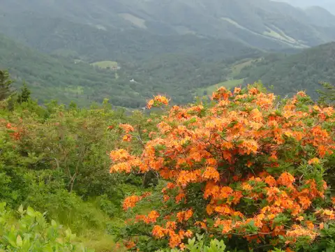 Spring · mid-March to JuneSpring wildflowersWildflowers by elevation, waterfalls in full flow, gardens and festivals.
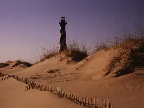 Summer · mid-April to SeptemberBeach townsFrom the Grand Strand to the Outer Banks: the beach towns in reach, by where you start.