Charlotte, North Carolina

Charlotte neighborhood guide

Charlotte covers 312 square miles round Uptown. This guide maps 11 of its neighborhoods, from Uptown and South End to University City and Ballantyne, with 22 greenways, 9 museums and 11 parks, and for each what a home costs, the best-known places to eat, drink and see, and how to get between them by light rail, greenway and road.

Map: © OpenStreetMap contributors (opens in a new tab); neighborhood areas: Mecklenburg County GIS (opens in a new tab) (MIT; its service districts (opens in a new tab) CC BY 4.0) and the NC State Historic Preservation Office (opens in a new tab)

Charlotte neighborhoods

Where to go in the city

11 neighborhoods, from the center out: what a home costs there, the best-known places to eat, drink and see, and how to get there and on to the next. The map follows along.

  1. 1 of 11 · The city center

    Uptown
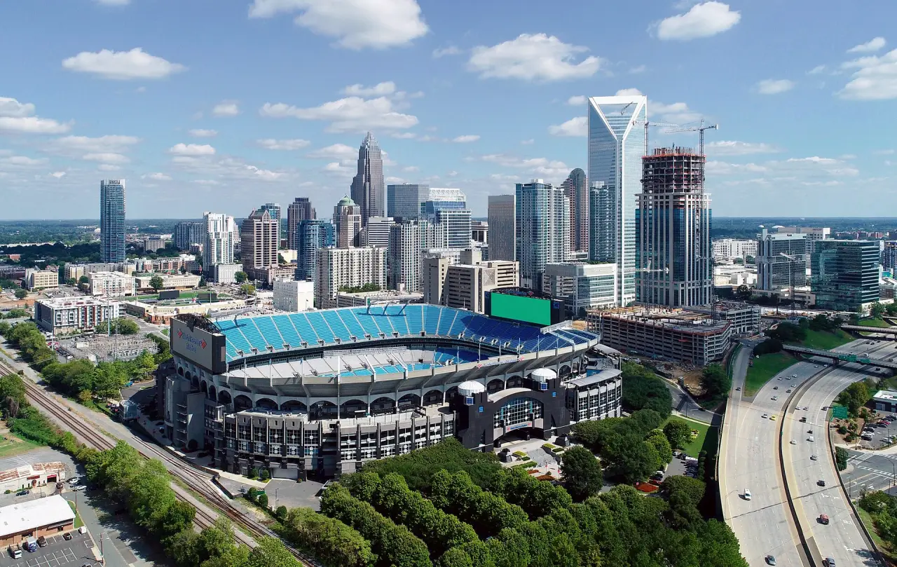
    Uptown Charlotte's skyline from the air, with Bank of America Stadium in front
    Uptown from the air, with Bank of America Stadium, October 2018Photo: Precisionviews, edited by Cmao20, CC BY-SA 4.0, Wikimedia Commons (opens in a new tab)

    Uptown Charlotte, also called Center City, is the central business district of Charlotte, North Carolina, United States. The area is split into four wards by the intersection of Trade and Tryon Streets, and bordered by Interstate 277 and Interstate 77. Wikipedia on Uptown (opens in a new tab)

    Median home
    about $464k
    11 census tracts, $192k to $823k, ACS 2020–2024
    Eat and drink
    328
    Breweries and distilleries
    2
    Arts and music
    56

    Places counted within 0.7 mi of its center.

    What to do

    Getting here and around

    • Light rail

      Blue Line: CTC/Arena, 3rd Street/Convention Center, 7th Street, 9th Street, Brooklyn Village. Gold Line: Tryon Street, CTC/Arena, Mint Street, Gateway Station, Davidson Street, McDowell Street, Johnson & Wales, Irwin Avenue.

    • Greenways
      • Charlotte Rail Trail
      • Irwin Creek Greenway
      • Wesley Heights Greenway
    • By road
  2. 2 of 11 · 1.3 mi from Uptown

    South End

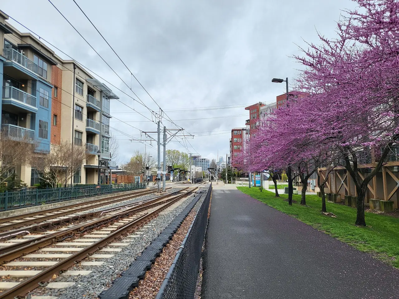
    The Rail Trail beside the Blue Line's tracks at New Bern station, redbuds in flower and flats beyond
    The Rail Trail and the Blue Line at New Bern station, South End, March 2024Photo: City Dweller 2, CC BY-SA 4.0, Wikimedia Commons (opens in a new tab)

    South End is a high-density commercial and residential neighborhood immediately southwest of Uptown Charlotte. It is also one of several Municipal Service Districts in Charlotte. Wikipedia on South End (opens in a new tab)

    Median home
    about $583k
    8 census tracts, $352k to $823k, ACS 2020–2024
    Eat and drink
    178
    Breweries and distilleries
    8
    Arts and music
    17

    Places counted within 0.6 mi of its center.

    What to do

    Getting here and around

  3. 3 of 11 · 1.5 mi from Uptown

    Dilworth

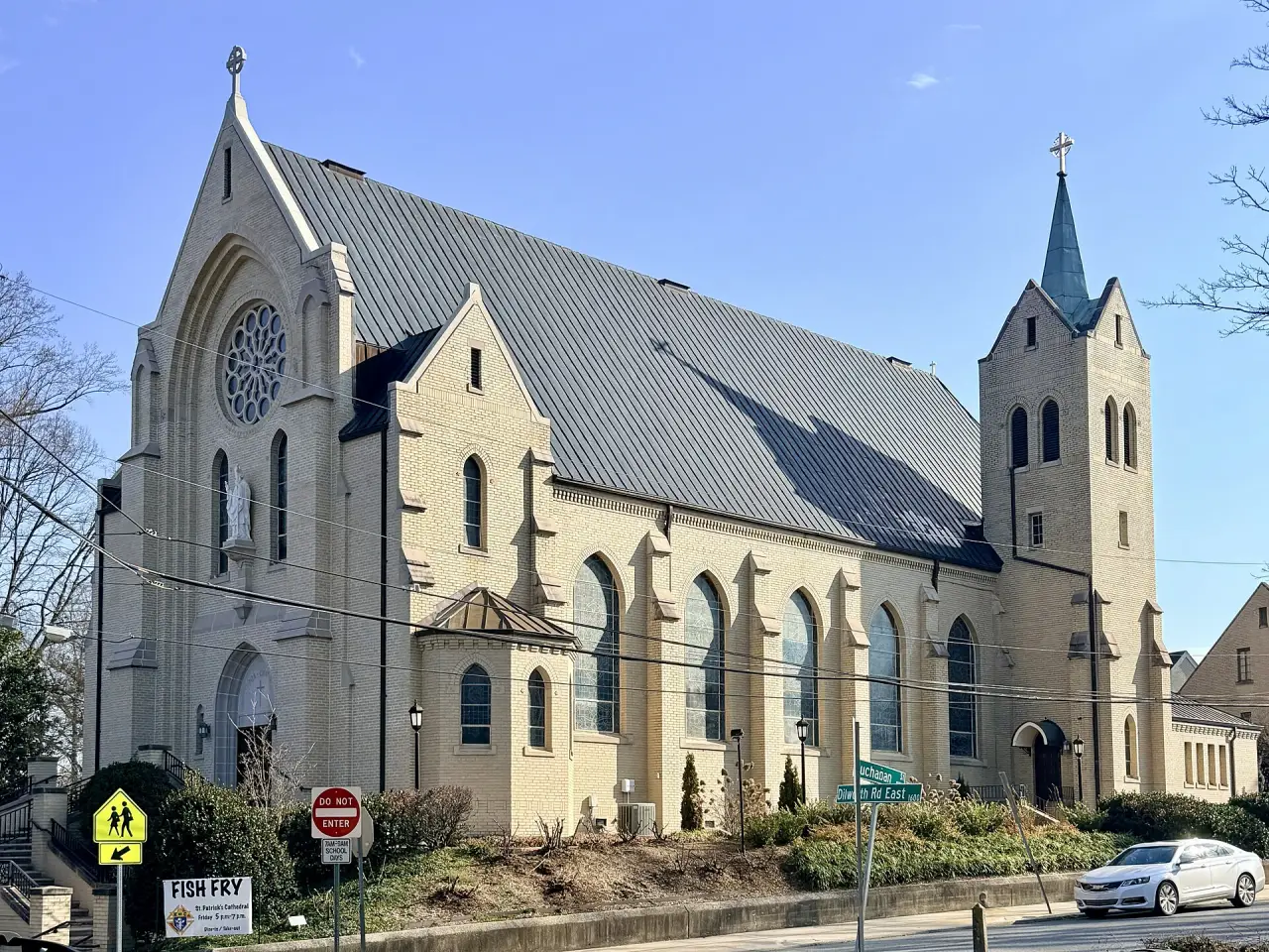
    The Cathedral of Saint Patrick's pale stone front, rose window and spire on a sunny morning
    The Cathedral of Saint Patrick on Dilworth Road East, Dilworth, March 2026Photo: Farragutful, CC BY-SA 4.0, Wikimedia Commons (opens in a new tab)

    Dilworth is a neighborhood of Charlotte, Mecklenburg County, North Carolina, United States. The neighborhood was Charlotte's first streetcar suburb and was established by Edward Dilworth Latta in the 1890s on 250 acres (1 km²) southwest of the original city limits. Wikipedia on Dilworth (opens in a new tab)

    Median home
    about $843k
    3 census tracts, $490k to $907k, ACS 2020–2024
    Eat and drink
    19
    Arts and music
    2

    Places counted within 0.5 mi of its center.

    What to do

    Getting here and around

  4. 4 of 11 · 2.5 mi from Uptown

    Myers Park

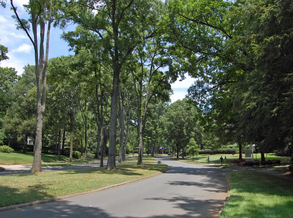
    A street under a canopy of tall willow oaks, with a cyclist riding through
    Myers Park's tree-lined streets, July 2007Photo: Bz3rk, CC BY-SA 3.0, Wikimedia Commons (opens in a new tab)

    Myers Park is a neighborhood and historic district in Charlotte, North Carolina, United States. Nearby neighborhoods include Dilworth and Sedgefield to the west, Eastover to the east, Uptown Charlotte to the north, and SouthPark and Foxcroft to the south. Wikipedia on Myers Park (opens in a new tab)

    Median home
    about $1.3M
    3 census tracts, $606k to $1.5M, ACS 2020–2024
    Eat and drink
    25
    Arts and music
    11

    Places counted within 0.7 mi of its center.

    What to do

    Getting here and around

  5. 5 of 11 · 1.4 mi from Uptown

    Elizabeth

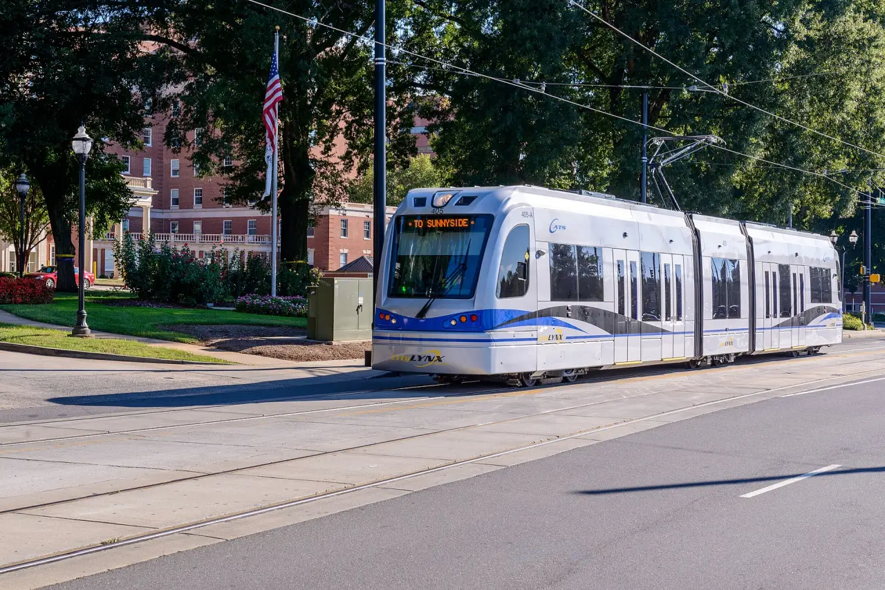
    A white and blue Gold Line streetcar on Hawthorne Lane under tall oaks, a brick hospital building behind
    A Gold Line streetcar on Hawthorne Lane, Elizabeth, September 2021Photo: Mark Clifton, CC BY-SA 2.0, Wikimedia Commons (opens in a new tab)

    Elizabeth takes its name from Elizabeth College, a small Lutheran women's college founded in 1897 on the present-day site of Presbyterian Hospital. The community began in 1891 when a streetcar was established along East Trade Street to the area, making it the second oldest streetcar suburb in Charlotte. Wikipedia on Elizabeth (opens in a new tab)

    Median home
    about $638k
    2 census tracts, $569k to $638k, ACS 2020–2024
    Eat and drink
    57
    Breweries and distilleries
    1
    Arts and music
    8

    Places counted within 0.4 mi of its center.

    What to do

    Getting here and around

  6. 6 of 11 · 1.9 mi from Uptown

    Plaza Midwood

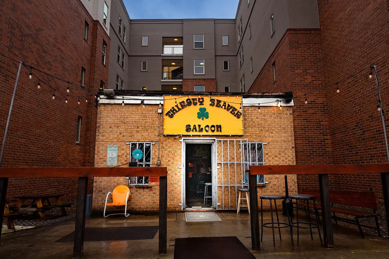
    The Thirsty Beaver Saloon's small brick front and yellow sign, with a patio, between the walls of new apartments
    The Thirsty Beaver Saloon on Central Avenue, Plaza Midwood, March 2022Photo: David D'Agostino, CC BY-SA 4.0, Wikimedia Commons (opens in a new tab)

    Plaza Midwood is a neighborhood located approximately one mile to the east of Uptown in Charlotte, North Carolina. The neighborhood is roughly bound by Hawthorne Lane to the west, The Plaza to the north, Briar Creek Road and the Charlotte Country Club to the east and Central Avenue to the south. Wikipedia on Plaza Midwood (opens in a new tab)

    Median home
    about $625k
    2 census tracts, $625k to $694k, ACS 2020–2024
    Eat and drink
    72
    Breweries and distilleries
    4
    Arts and music
    6

    Places counted within 0.6 mi of its center.

    What to do

    Getting here and around

  7. 7 of 11 · 2.5 mi from Uptown

    NoDa

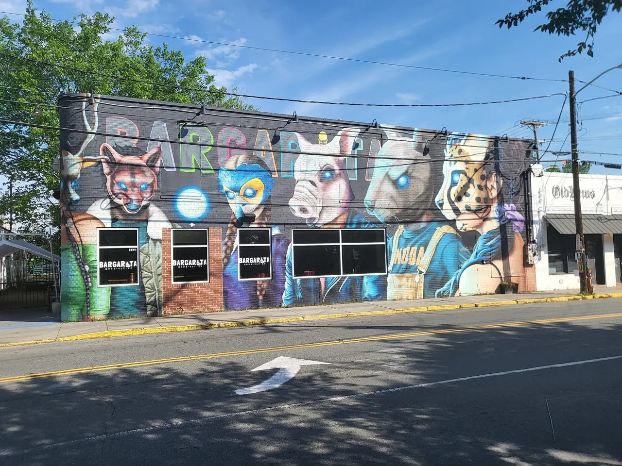
    A brick building on North Davidson Street painted with a huge mural of animals in sunglasses, under a blue sky
    A mural on North Davidson Street, NoDa, April 2024Photo: City Dweller 2, CC BY-SA 4.0, Wikimedia Commons (opens in a new tab)

    NoDa is a popular arts district in Charlotte, North Carolina, United States. It is located in the North Charlotte neighborhood centered around North Davidson Street and 36th Street, approximately two and a half miles northeast of Uptown. Wikipedia on NoDa (opens in a new tab)

    Median home
    about $550k
    2 census tracts, $376k to $550k, ACS 2020–2024
    Eat and drink
    61
    Breweries and distilleries
    8
    Arts and music
    14

    Places counted within 0.6 mi of its center.

    What to do

    Getting here and around

  8. 8 of 11 · 1.5 mi from Uptown

    Camp North End

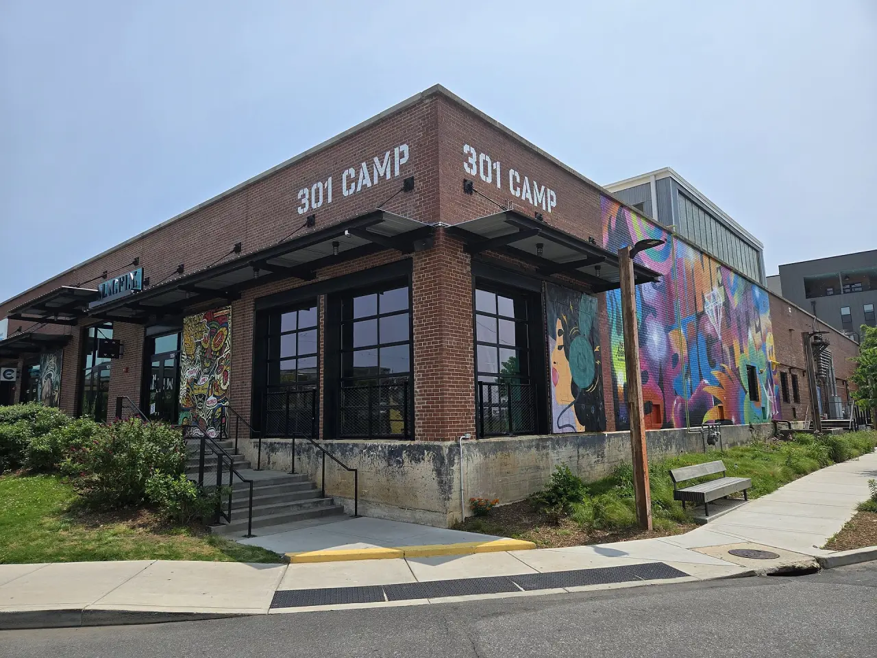
    301 Camp, a long brick building of the old Ford plant, with big windows and a bright mural down its side
    The 301 Camp building at Camp North End, June 2025Photo: City Dweller 2, CC BY-SA 4.0, Wikimedia Commons (opens in a new tab)

    Camp North End is Ford's old Charlotte assembly plant on Statesville Avenue, which built Model Ts and Model As from 1924 to 1933 and missiles for the Army from 1955 to 1964, and was sold for redevelopment in 2017. Wikipedia, List of Ford factories (opens in a new tab)

    Homes around it
    about $256k
    2 census tracts, $256k to $279k, ACS 2020–2024
    Eat and drink
    17
    Breweries and distilleries
    1
    Arts and music
    2

    Places counted within 0.2 mi of its center.

    What to do

    Getting here and around

    • Light rail

      No station within a 10-minute walk of its center. Nearest, as the crow flies: Blue Line at Parkwood, 0.9 mi; Gold Line at Gateway Station, 1.4 mi.

    • Greenways

      None of the mapped greenways runs through it.

    • By road
  9. 9 of 11 · 5.4 mi from Uptown

    SouthPark

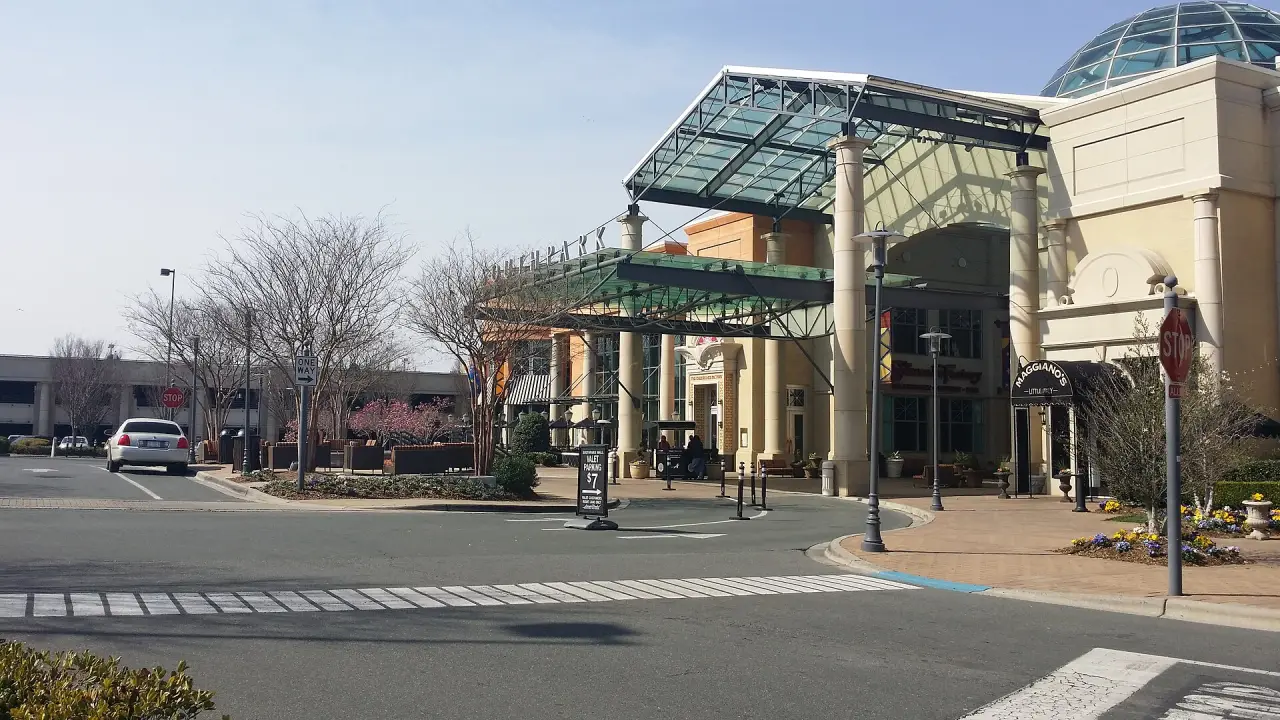
    SouthPark Mall's glass canopy and domed entrance, with a crossing in front
    The entrance to SouthPark Mall, March 2014Photo: HangingCurve, CC BY-SA 4.0, Wikimedia Commons (opens in a new tab)

    SouthPark is an area edge city in Charlotte, North Carolina, United States. Its name is derived from the upscale SouthPark Mall, which opened on February 12, 1970. Wikipedia on SouthPark (opens in a new tab)

    Median home
    about $716k
    6 census tracts, $665k to $1.6M, ACS 2020–2024
    Eat and drink
    103
    Breweries and distilleries
    2
    Arts and music
    4

    Places counted within 1 mi of its center.

    What to do

    Getting here and around

  10. 10 of 11 · 8 mi from Uptown

    University City

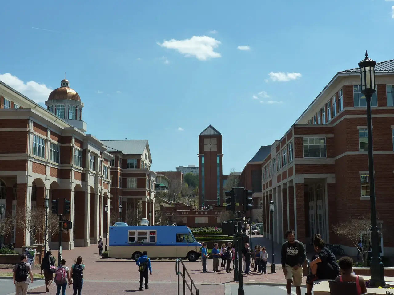
    Students crossing a brick plaza between red-brick buildings on the UNC Charlotte campus, a clock tower beyond
    The UNC Charlotte campus, April 2013Photo: chucka_nc, CC BY-SA 2.0, Wikimedia Commons (opens in a new tab)

    University City is an edge city mostly within the city limits of Charlotte, North Carolina, United States, surrounding the University of North Carolina at Charlotte campus. It is found in northeastern Mecklenburg County, southeast of Interstate 85 and predominantly along University City Boulevard and W.T. Harris Boulevard. Wikipedia on University City (opens in a new tab)

    Median home
    about $309k
    8 census tracts, $195k to $589k, ACS 2020–2024
    Eat and drink
    141
    Breweries and distilleries
    1
    Arts and music
    1

    Places counted within 1.5 mi of its center.

    What to do

    Getting here and around

  11. 11 of 11 · 11.9 mi from Uptown

    Ballantyne

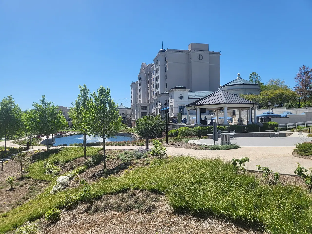
    The Ballantyne hotel's tower and a gazebo above a pond and planted banks in Stream Park
    The Ballantyne hotel from Stream Park, April 2024Photo: City Dweller 2, CC BY-SA 4.0, Wikimedia Commons (opens in a new tab)

    Ballantyne is a neighborhood and developing edge city on the southside of Charlotte, North Carolina, occupying a 2,000-acre (8.1 km2) area of land adjacent to the South Carolina border. The neighborhood is home to St. Matthew Catholic Church. Wikipedia on Ballantyne (opens in a new tab)

    Median home
    about $522k
    8 census tracts, $375k to $853k, ACS 2020–2024
    Eat and drink
    100
    Breweries and distilleries
    1
    Arts and music
    5

    Places counted within 1.5 mi of its center.

    What to do

    Getting here and around

Home values: U.S. Census Bureau, American Community Survey 2020–2024 (table B25077, the median value of owner-occupied homes) by census tract, each neighborhood’s figure the median of the medians of the tracts its edge on the map covers, weighted by the area of each inside it; the range is those tracts’ lowest and highest. Openings from Wikipedia (CC BY-SA 4.0), by revision; places from Overture Maps and © OpenStreetMap contributors; photos from Wikimedia Commons, credited under each.

Two days out

The Whitewater Center and Carowinds

The two big days out at the city’s edge: the rapids, trails and climbing of the U.S. National Whitewater Center to the west, and Carowinds’ roller coasters astride the state line to the south.

  1. A day out · 9.3 mi from Uptown, 25 min by road

    U.S. National Whitewater Center

    A blue raft of paddlers in helmets plunging through white water on the center's channel
    Rafting the channel at the U.S. National Whitewater Center, September 2011Photo: Cpl. Ed Galo, U.S. Marine Corps, Public domain, Wikimedia Commons (opens in a new tab)

    The U.S. National Whitewater Center (USNWC) is a not-for-profit outdoor recreation and athletic training facility for whitewater rafting, kayaking, canoeing, rock climbing, mountain biking, hiking and ice skating which opened to the public in 2006. The Center is located in Charlotte, North Carolina on approximately 1,300 acres (530 ha) of land adjacent to the Catawba River, with more than 50 miles (80 km) of developed trail. Wikipedia on U.S. National Whitewater Center (opens in a new tab)

    Getting there

  2. A day out · 10.2 mi from Uptown, 21 min by road

    Carowinds

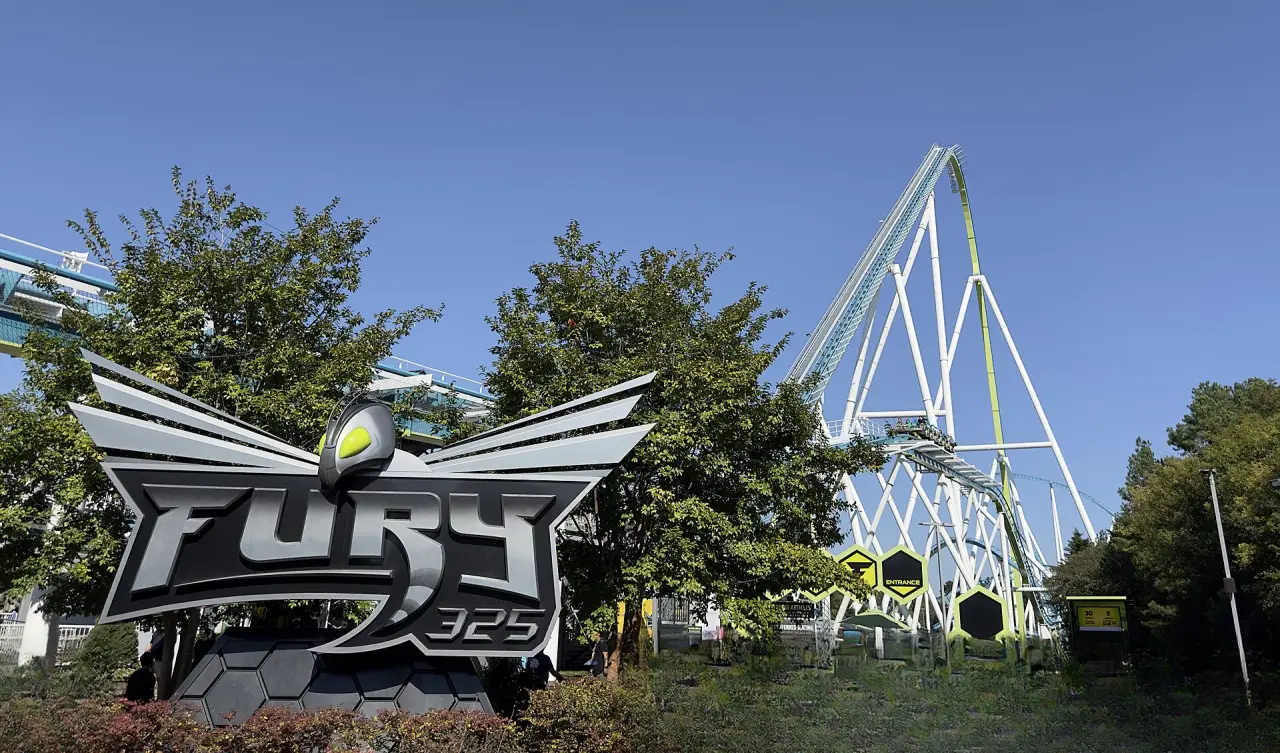
    Fury 325's winged entrance sign in front of the coaster's tall white lift hill and teal track
    Fury 325's entrance and lift hill at Carowinds, October 2024Photo: ThrillZing, CC BY 4.0, Wikimedia Commons (opens in a new tab)

    Carowinds is a 407-acre (165 ha) amusement park primarily located in Charlotte, North Carolina. The park is owned and operated by Six Flags. Carowinds straddles the state line between North and South Carolina, adjacent to Interstate 77, with a portion of the park located in York County, South Carolina. The state line is painted and runs through the main entrance area of the park. Wikipedia on Carowinds (opens in a new tab)

    Getting there

Between the neighborhoods

Light rail, greenways and drives

Two light rail lines serve 6 of the 11 neighborhoods, each station within a 10-minute walk of the center it is listed under; the greenways thread between others; and by road no two places on this page are more than 38 min apart without traffic.

LYNX Blue Line

  1. JW Clay Boulevard/UNC CharlotteUniversity City
  2. McCulloughUniversity City
  3. University City BoulevardUniversity City
  4. Tom Hunter
  5. Old Concord Road
  6. Sugar Creek
  7. 36th StreetNoDa
  8. 25th Street
  9. Parkwood
  10. 9th StreetUptown
  11. 7th StreetUptown
  12. CTC/ArenaUptown
  13. 3rd Street/Convention CenterUptown
  14. Brooklyn VillageUptown
  15. CarsonSouth End
  16. Bland StreetSouth End
  17. East/West BoulevardSouth End
  18. New BernSouth End
  19. Scaleybark
  20. Woodlawn
  21. Tyvola
  22. Archdale
  23. Arrowood
  24. Sharon Road West

CityLynx Gold Line

  1. Hawthorne & 5th StreetElizabeth
  2. Elizabeth & HawthorneElizabeth
  3. CPCC Central Campus
  4. McDowell StreetUptown
  5. Davidson StreetUptown
  6. CTC/ArenaUptown
  7. Johnson & WalesUptown
  8. Gateway StationUptown
  9. Mint StreetUptown
  10. Irwin AvenueUptown
  11. Hawthorne & 8thElizabeth
  12. Sunnyside AvenueElizabeth, Plaza Midwood
  13. French Street
  14. Johnson C. Smith University
  15. Bruns Avenue
  16. Wesley Heights
  17. Tryon StreetUptown
Drive times between the neighborhoods, the Whitewater Center and Carowinds, in minutes
FromUptownSouth EndDilworthMyers ParkElizabethPlaza MidwoodNoDaCamp North EndSouthParkUniversity CityBallantyneWhitewater CenterCarowinds
Uptown4 min6 min8 min5 min6 min8 min5 min13 min18 min25 min25 min21 min
South End4 min2 min7 min6 min8 min10 min8 min13 min20 min23 min24 min19 min
Dilworth6 min2 min5 min6 min8 min11 min10 min11 min22 min22 min26 min21 min
Myers Park8 min7 min5 min6 min8 min11 min11 min8 min24 min22 min29 min23 min
Elizabeth5 min7 min7 min6 min2 min8 min7 min10 min19 min24 min27 min24 min
Plaza Midwood6 min8 min8 min8 min2 min6 min8 min12 min17 min26 min28 min25 min
NoDa8 min10 min12 min12 min8 min6 min6 min17 min13 min30 min28 min26 min
Camp North End5 min8 min10 min12 min9 min10 min6 min17 min14 min27 min25 min23 min
SouthPark13 min12 min11 min8 min10 min12 min16 min15 min27 min14 min32 min19 min
University City18 min21 min23 min25 min19 min17 min13 min15 min27 min38 min33 min35 min
Ballantyne25 min22 min22 min22 min24 min26 min30 min28 min15 min38 min30 min16 min
U.S. National Whitewater Center27 min26 min28 min31 min29 min31 min32 min29 min34 min35 min31 min29 min
Carowinds22 min19 min21 min23 min23 min25 min27 min24 min19 min35 min15 min27 min

Stations and lines © OpenStreetMap contributors, run by CATS (the Charlotte Area Transit System); drive times worked out with OSRM on OpenStreetMap roads, without traffic, so allow a little extra.

Charlotte facts

The city by the numbers

Charlotte is the most populous city in the U.S. state of North Carolina. With a population of 874,579 at the 2020 census, it is the 14th-most populous city in the U.S., seventh-most populous city in the South, and second-most populous city in the Southeast. The Charlotte metropolitan area, with an estimated 2.88 million residents, is the 21st-largest metropolitan area in the U.S. and lies at the center of an 18-county combined statistical area with an estimated population of 3.47 million as of 2024. Charlotte is the county seat of Mecklenburg County.

Population, 2020 census
874,579
964,784 estimated for 2025
Area
312 sq mi
310 sq mi of it land
Incorporated
1768
Settled in 1755
Metro area
2,883,370
People in the wider region
Elevation
746 ft
Above sea level
Sunset tonight
—

Figures from Wikipedia’s Charlotte article (opens in a new tab) (CC BY-SA 4.0); sunset worked out for Uptown.

The map

Explore the city

Its neighborhoods, museums, parks and greenways, inside the city limits. Pick one here, or point at the pins on the map.

Pick a neighborhood or a place, here or on the map.

Out and about

Greenways, parks and museums

The city’s greenways by length as mapped, its central and largest parks, and its museums and landmarks. Hover or tap any of them to find it on the map.

Greenways

From © OpenStreetMap contributors

Parks

From © OpenStreetMap contributors

Museums

From © OpenStreetMap contributors

Landmarks

From © OpenStreetMap contributors

Out from Charlotte

The best day trips out of the city

The towns our day-trip planner ranks highest from Charlotte, with the drive by road without traffic.

Things to do on Lake Norman, north of the city

Events and concerts

What’s on in Charlotte

The city’s official event calendars, from its visitors’ bureau, Uptown, the county’s parks and its venues. Each opens on its own site.

External calendars, checked October 9, 2026. Check the listing before you go: plans change.